
Urban Development in Mumbai and its Effect on Coastal Communities
Coastal regions have always had significant historical and socio-political value, making them the target of ambitious urban development plans. Amit Devale zooms in on the situation of Mumbai’s indigenous coastal tribes and their relationship with the city – and how local government plans affect their lives.
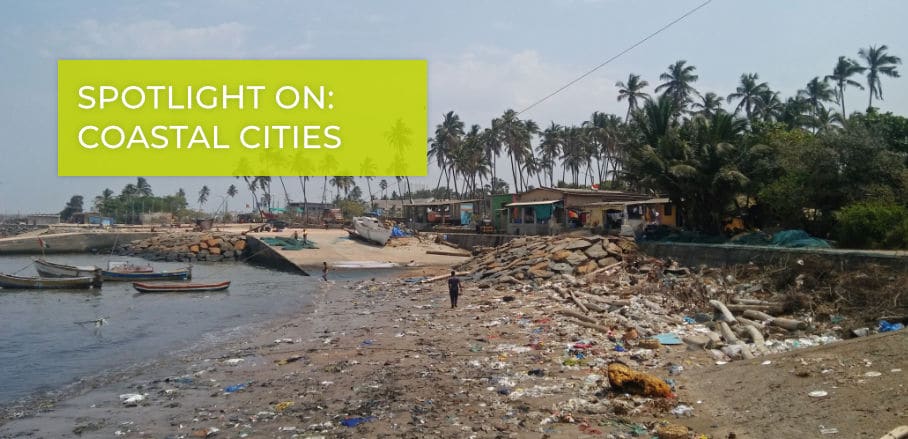
Coastal cities always have been amongst the best places to live. As they are located by the sea, and typically well connected to other parts of the mainland, they have obviously become a prime destination for many people. The microclimate, type of soil, and terrain of coastal cities is completely different compared to the mainland of the country, and continue to be of immense importance with regards to defence, economics and tourism. This is also true for India, which has a coastline of 7500 odd kilometres. These coastal regions accommodate various tribes and indigenous communities but in order to cater to the rising number of people living in India’s coastal areas, the infrastructure in these cities is being continuously expanded, increasing the burden placed upon them day by day. But how is a coastal region defined and what makes humans opt for taking shelter along the coast in the first place?
Coastal Regions
Coastal regions are primarily defined as regions or parts of land adjoining the coastline. On average, a distance of about 60 kilometres from the shoreline to the terrestrial side is still considered part of the coastal belt. A demographic study further states that almost 40 per cent of the world’s population stays within 100 kilometres of the coastline, with approximately 150 million people staying on land that is likely to go below the high-tide line by 2050. Considering the magnitude of monsoon flooding every year, for India, this scenario might not even take place as late as 2050, but much sooner.
Still, people have always settled on coasts to take advantage of the amenities the oceans offer, such as food supply, source of transport and defensible positions. The abundance of water and other natural resources unique to coastal regions makes them one of the most habitable regions in all of human history. Indeed, most of the vital civilisations we have studied, and which are known to have survived for a long time, began at the banks of a river.
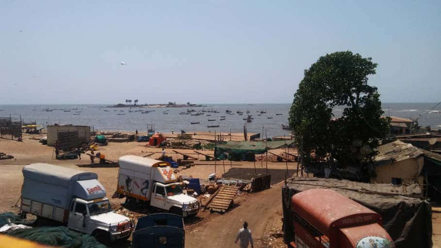
Trombay koliwada fishing village © Amit Devale
Urban Threats to India’s Indigenous Coastal Communities
Kolis, Bhils, Gonds, Agris, and others, are amongst the various indigenous communities found in the coastal areas of Greater Mumbai. While the Kolis are into fishing, the Agris win salt from the saltpans and distribute it further to the city. The Gonds are involved in agriculture, and the Bhils, on the other hand, work in animal husbandry, poultry farming, and manual labour. All of these communities have shaped their respective cities in such a meaningful and unique way, that we cannot even imagine these cities without their contribution.
Architecture, food, clothing, festivals, traditions and culture, and so much more can be credited to them. In addition, a lot of the domestic help as well as many of the informal jobs, which are not documented and covered for by the government, are performed by people from these communities. Try imagining a society without all of these things, and you will realise how important a role these indigenous communities play in our life.
These communities, however, are in danger of extinction. Being an integral part of cities, they have changed their lifestyles significantly to adapt more to city life, trying to cope with their present surrounding, just to sustain and survive. Indeed, indigenous communities are as dependant on cities as cities are on them. Moreover, since coastal regions are of prime real estate value, they are eyed by many wealthy people in the country. This poses a serious threat to the livelihood of indigenous communities.
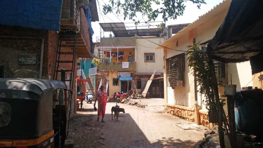
Madh koliwada fishing village © Amit Devale
This is further exacerbated by the fact that the Indian government refuses to even acknowledge these communities, let alone make any provisions for them. In Mumbai and its Metropolitan Region, these indigenous settlements were not even identified in the city’s development planning process and the ensuing Development Plan 2034. NGOs and other non-profit organisations in Mumbai have been working hard to receive a special set of Development Control Regulations for these settlements to provide them with better infrastructure, better hygiene, and overall improved quality of life, and to encourage their original occupations by some means – a lengthy process that is thankfully taking good shape now.
Insufficient Disaster Mitigation Plans
Another major problem coastal regions face is massive flooding: in the cloudburst of the 2005 monsoon, Mumbai flooded like never before in history, experiencing rainfall of 944 millimetres within 24 hours. This caused over 550 crore Indian Rupees worth of damage and took more than 1000 lives. The British had designed Mumbai’s stormwater drain for a capacity of 25 millimetres of rainfall. On July 26th 2005, however, this number was close to 45 millimetres, which was almost double the carrying capacity of the drain at that time. A fact-finding committee later recommended the provision of three pumping stations across the city as a primary solution to the recurring floods. But it was not until 2011 that the first pumping station was eventually commissioned.
The Municipal Corporation of Greater Mumbai (MCGM) had indeed documented all the contours and low-lying areas in the city and its suburbs in detail in its existing land use survey of the Development Plan 2034. It showed a clear demarcation of areas that are at risk of flooding. Despite having such rich data of the contours and elevations, the MCGM did not take any precautionary measures while preparing the proposed land use plan. On the contrary: they planned dense residential neighbourhoods on these parcels of land, thus making the situation even worse. New development sites have been built on greenfield sites and catchment areas, with no connectivity to public transportation or road networks, turning them into isolated vulnerable islands in all terms.
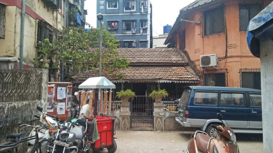
Versova koliwada fishing village © Amit Devale
Necessary Steps for Local Government
Local government must accommodate all of these facts and act on them in order to preserve India’s indigenous coastal settlements and provide adequate urban development and infrastructure plans, tailored the needs of such communities. The municipal corporation plays a vital role in this game but is still playing at backfoot. As mentioned earlier, the contour and elevation data needs to be studied and the necessary actions taken in order to avoid further disasters.
Finally, waterfronts have always been a public realm, and should always be open for the public; for their recreation and for the city to have a breathing void. Ambitious urban development plans that favour privatisation have the disadvantage that the regions will lose out on a good deal of public open spaces – and it would become difficult, even impossible, to then force bylaws on to privatised lands. Also, most of the indigenous communities that live on the coastal belts might lose their existence due to privatisation; similar to the consequences we can already observe in the Indian mainland.
The coastline needs to be dealt with sensible and sensitive planning mechanisms, most importantly, by prioritising the people. The Development Plan 2034 is a good catalyst to this proposition and must be strictly conformed to.

Amit is currently working as an Associate Director at Urban Design Research Institute where his expertise lies in verbal and written communication with the municipal authorities, indigenous communities, and various other stakeholders in the public participation process for Mumbai city and its metropolitan region.
- Urban Development in Mumbai and its Effect on Coastal Communities - 8. September 2020