
Categorising South Africa’s Resilient Urbanisms
Urban planning during the apartheid regime specifically designed cities to displace and separate. Ngaka Mosiane, Mamokete Matjomane, and Avhatakali Sithagu argue for a concept of spatial culture that captures this particularity of South Africa’s resilient urban history.
What is a Landscape?
The idea of the landscape is burdened with its debates based on the Anglo-American contexts. Accounts range from landscapes as finished, detached, and universalised areas, to conceptualising them as a lived and experiential spaces. Landscapes are always about a set of social relations that are transformed into a concrete material – “… a syncretic space, man-made system of spaces superimposed on the face of the land…”, as John B. Jackson worded it[1]Jackson, J.B. (1984) Discovering the Vernacular Landscape. New Haven: Yale University Press..
In this sense, as Donald Mitchell argues[2]Mitchell, D. 2000. Cultural Geography: A Critical Introduction.Oxford: Blackwell., the landscape is both a product of the work that has gone into making it, and a means of social reproduction – it hardens the division of labour behind its production, in the process mystifying such social relations. A landscape concretises the wishes, desires, and fears of those in power on a canvas, a photo stock, on the ground, in the stones, bricks, mortar, wood, tar, and lumber of a city, town, village, or rural setting. The landscape thus becomes an imposition of power, in the process legitimising the exclusion of some landscapes.
Having said that, landscape production and its meaning-making processes are contested and struggled over sets of social relationships. Thus, a process of building an upmarket city centre, a town, a village, or rural area can end up being a jumbled, compromised product of struggle.
What Makes Landscapes Peripheral?
Some landscapes are considered ‘peripheral’ or to be in the peripheries of cities and city-regions. Summarising Sally Peberdy’s analysis[3]Peberdy, S. (2017). Uneven development - core and periphery in Gauteng, in S. Peberdy, P. Harrison and Y. Dinath, Uneven spaces: core and periphery in the Gauteng City-Region (pp. 21-200). Report of the Gauteng City-Region Observatory, Johannesburg., these are often places of low economic development and socio-economic marginalisation. “Peripheral” in this regard is not only a spatial attribute, as these places can also be located in city centres or their edges. This aspatial attribute of peripherality also implies that being located outside the city core area does not necessarily equate to social and economic marginality. Periphery also has a relational dimension – a peripheral area located in the outskirts of the city may be a core area in relation to its surrounds. Additionally, a periphery has a temporal quality – its role can, over time, change from being a periphery to being a centre and vice versa. Some peripheral areas have their own historical developments, which may result in, for example, a mining, agricultural, or recreational area to not simply lie in the outskirts of a major city, but also to have an interdependent relationship with such a city.
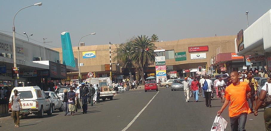
Peripherality may also be an outcome of state policies. In South Africa, landscapes of displaced urbanisms were formed by ‘displacing’ black Africans from urban and farm areas reserved for white people. Through the apartheid ideology of separate development, black Africans were displaced to the outskirts of towns and cities, mainly within the bantustans: areas reserved for black Africans, with the status of either fake self-governance or pseudo-independence. These symbols of apartheid injustices, which resisted their creation, continue to subtly transform and reproduce themselves.
Spatial Apartheid – A Typology of Transformation
One result of such processes are areas characterised by dispersed, low-density, rural settlements. Second, there are those displaced areas that are mainly agricultural, which are called ‘betterment villages’ – a kind of planned site-and-services settlement like Ramatlabama near Mafikeng. Other examples can be found in the former Ciskei bantustan.
These first two settlement forms share the characteristic of being linked through poor road and transportation infrastructure to a town or city that is often more than 100 kilometres away.
Third, there are those displaced areas with a township-like character. In addition to being linked to distant cities, they are also connected to former industrial decentralisation points located near or inside the borders of ‘white South Africa’. These industrial areas were unable to maintain viable economic thresholds because of their significant distances away from urban centres, thus leaking out their purchasing power to those urban centres.
Fourth, there are city-sized settlements that are not-quite-urban and not-quite-rural, although they are largely under communal land tenure systems.
Spatial Cultures
The idea of ‘displaced urbanisms’ captures a spatial culture that includes dispersed rural areas, ‘townships’[4]A township in South Africa is not designed according to the modern town planning principles of land-use plans laid out for residential, commercial or industrial developments. The planning of the South African townships is essentially linked to apartheid spatial planning – they were built for black Africans without adequate infrastructure for basic services and amenities, relegated as dormitory labour reserves located away from major economic centres. , and manages to include settlements that are neither urban nor rural. It expresses the interface between modernity and tradition, as these areas imitate the material and symbolic objects associated with the city, for example through construction of suburbia-style houses in a predominately rural context. The idea also captures residents who make significant investments in modern house designs, yet maintain a deep connection to tradition, custom, and land in other house designs.
Many residents of these “displaced urbanisms” are in constant limbo, because their former bantustans “do not satisfy their social and economic needs and aspirations” as the Centre for Development Enterprise noted, thus producing a significant amount of daily commuters to major urban areas for work.
This is as they continue to subtly and seductively co-produce their space; expressing their aspiration for good life of status and wealth through building suburbia-style houses. They also express a desire for a semblance of power that instils in them a sense of control, regulation, custom, and tradition. At times their spaces are glaringly noticeable and distinguishable from those of city lives due to their constant negotiation with poverty, inequality, and spatial separation from the rest of society.
The Future of Post-Apartheid South Africa
There is a tendency for the National Treasury to privilege investments in the metropolitan core areas. This happens at the expense of an option of extensive development processes which would balance investments throughout core, peripheral, and displaced areas. The National Treasury should provide people living in the peripheries with proper infrastructure and services.
In the end, the future of post-apartheid South Africa is in part being determined in these former bantustans, where unresolved questions of land and secure tenure are being contested and negotiated.


