
Accessibility is Affordability: Why Evaluating Urban Access is Key to Affordable Housing Policy
City planners and data scientists Santiago Fernández Reyes and Apaar Bansal explain how a new visual tool they developed can bridge the land use and transport policy gap – and push policymakers to provide adequate housing that is better located.
Cities in the Global South have paid a high price for pushing housing policies that do not consider mobility and urban access. This is particularly evident in countries with rapidly growing metropolitan areas like Mexico and India.
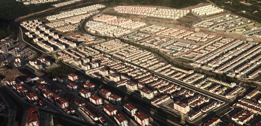
In Mexico, explosive urbanisation in the last two decades has led to privately built social housing developments on the outskirts of the cities, far from essential services and transportation options. Thus, it is no surprise that Mexico had over six million vacant houses and one million abandoned dwellings at one point, in large part due to how inaccessible they were.
India has experienced similar problems. Rapid rural-to-urban migration has led to the proliferation of informal settlements in major urban centres, which are often demolished by authorities with little prior notice. Displaced families are sometimes offered shelter in resettlement colonies far from the slums they once inhabited, but this move to the city fringes has been associated with a loss of livelihood, social connection, and income.
Why Evaluate Urban Access?
Urban access – or the ability to reach economic and social opportunities using various modes of transport – has become more and more popular as a measure of success for transportation and land use policies worldwide. The extent of urban access depends on the transport and mobility infrastructure available as well as the location of the destinations we need to reach each day. This is key when we are talking about affordable housing because the location of housing and the availability of transport options directly affect the time and monetary cost people incur to reach the services and economic opportunities they need to thrive.
The examples of Mexico and India above showcase the need for integrated land use and transport planning when determining affordable housing locations. Cities from Singapore to Paris have already developed long-term urban development plans with accessibility in mind (Singapore 20-minute towns, Paris ville du quart d’heure), where they have set transport and land use policy goals to guarantee key destinations are reachable within an acceptable travel time. However, this shift has yet to reach most countries in the Global South. Moreover, several challenges exist in the developing world, such as a lack of technical capacity to evaluate access indicators and a reluctance to share spatial and mobility data.
A New Tool to Evaluate Urban Access
Advances in open data and web tools present an opportunity to bridge this knowledge gap, making it possible to analyse accessibility indicators more quickly and cheaply than ever. To leverage this opportunity, ITDP Mexico, in partnership with the Inter-American Development Bank, created an online tool that simplifies the visualisation of relative access to jobs, health, educational, and recreational opportunities using open data sources and open-source tools.
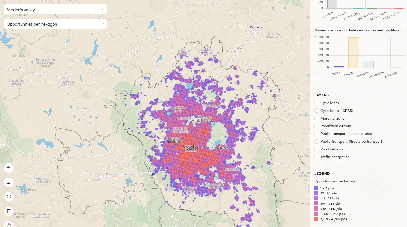
The accessibility tool interface shows the following reachable opportunities: number of jobs, companies, health clinics, educational institutions, parks, and grocery stores. The user can compare the number of reachable opportunities by the following travel modes: Walking, cycling, public transit (including informal network), and car (free flow and congested conditions separately). @ Apaar Bansal & Santiago Fernández-Reyes
Through collaborations with the Chilean BRT Center of Excellence and the Costa Rican Ministry of Urban Development, the tool now includes 20 cities in Mexico, 17 in Chile, and one in Costa Rica. By comparing standardized accessibility metrics by transport mode, cost, travel time, and emissions generated across multiple geographies, this interactive tool seeks to further the conversation around co-locating transportation infrastructure and urban development to enhance accessibility. It adds an open-source alternative to the existing collection of paid accessibility and open-access analysis software, with a particular focus on developing world applications.
Applications of the Tool to Affordable Housing
This tool can be used by a wide range of stakeholders involved in the planning and provision of affordable housing. Governments and policymakers can rely on tools like this to plan new housing or development in areas that are highly walkable or have good transit access, or to decide where new transport infrastructure and services should be established, such as in areas with a high population or number of opportunities.
Tools like this can inform low-income home buyers or renters which areas have better accessibility and are thus more desirable to live in considering their own needs, preferences, and available resources. Access to this information also leads to a more informed view regarding housing location decisions like moving to new social housing complexes, which in countries like Mexico and India often involves relocating to far-flung parts of the city.
The ability to download the data enables further analysis and research, such as the link between accessibility and socioeconomic indicators, or how urban access changes throughout the day for different modes and destinations. Ultimately, activists and citizens can use this tool to push policymakers to provide adequate housing that is better located, as well as matching mobility infrastructure that connects them to opportunities in different parts of the city.
Data Availability Remains a Challenge
As promising as this approach can be, data availability remains a challenge, both for the location of ‘opportunity’ datasets (jobs, schools, etc.) as well as mobility networks, which usually include informal systems for which scarce data exists. For the Mexico City Metropolitan Area, we were able to bridge this gap thanks to a unique dataset of metropolitan transport routes developed by WhereIsMyTransport which considered informal and semiformal public transport routes.
For other cities, there are great opportunities for governments to invest in the creation and dissemination of such spatial and mobility datasets, and to come together with private and non-government organisations to help advance conversations on how bridging the land use and transport policy gap can yield more sustainable and fair cities.

