
Infographics: Urbanisation and Urban Development in Rwanda
URBANET is back with a new country series, inviting readers to explore and learn about urbanisation in Rwanda! Starting off with a set of infographics we introduce you to some insightful facts and figures regarding the country’s urban and demographic development.
Urban and Rural Population
The graphic shows that more people live in rural areas than in cities. The rural population has been consistently increasing over time, except for a period between 1990 and 2000, when it remained stagnant due to the Rwandan Civil War (1990-1994) which ended after the genocide of the Tutsi minority ethnic group. On the other hand, the urban population started to grow quite slowly around 1960 but is expected to continue growing significantly until 2050.
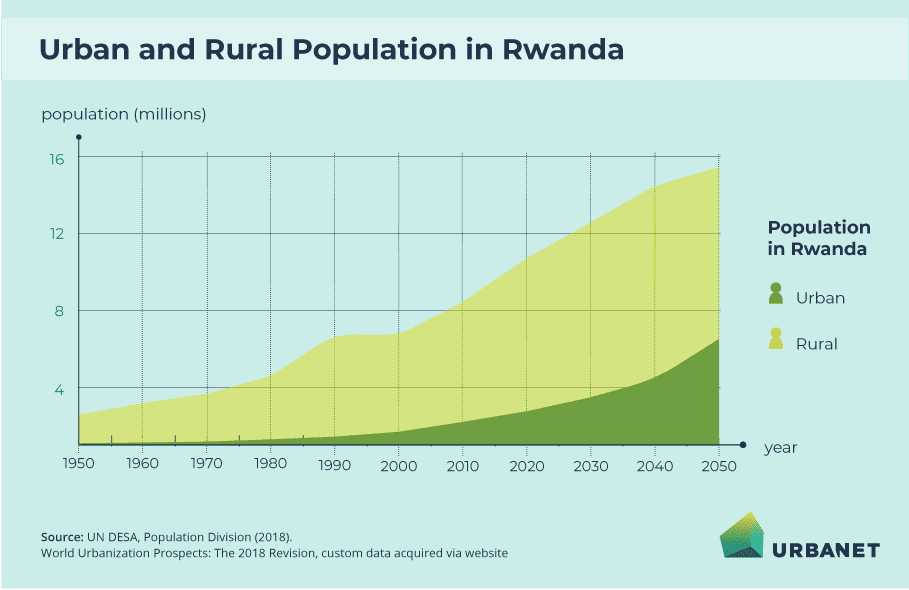
Urbanisation in Rwanda – Urban and Rural Population | Rwanda Infographics © GIZ
The Largest City in Rwanda
Although Rwanda’s urban population is clearly on the rise, the country merely consists of one larger agglomeration at the moment: Kigali. The country’s capital is projected to grow from approximately one million inhabitants in 2015 to more than 1.5 million inhabitants in 2030. Looking at the demographic development, it is estimated that cities in Rwanda will grow significantly within the next decade.
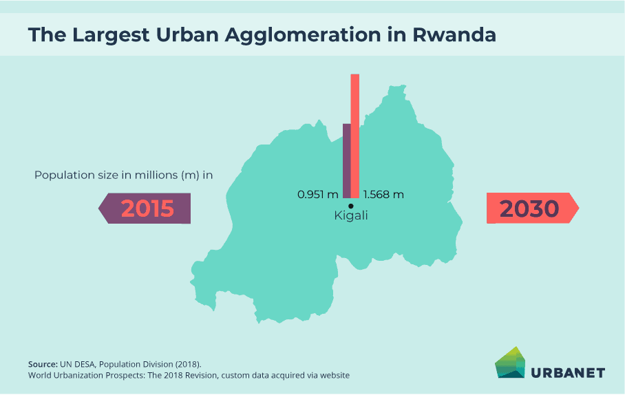
Urbanisation in Rwanda – Largest City in Rwanda | Rwanda Infographics © GIZ
Population Density in Rwanda’s 5 Provinces
The graphic displays that Rwanda’s population density is highest in Kigali: the capital inhabits approximately 2.401 people per square kilometre. Compared to this, the other provinces show a relatively low population density. The least amount of people per square kilometre lives in the Eastern Province.
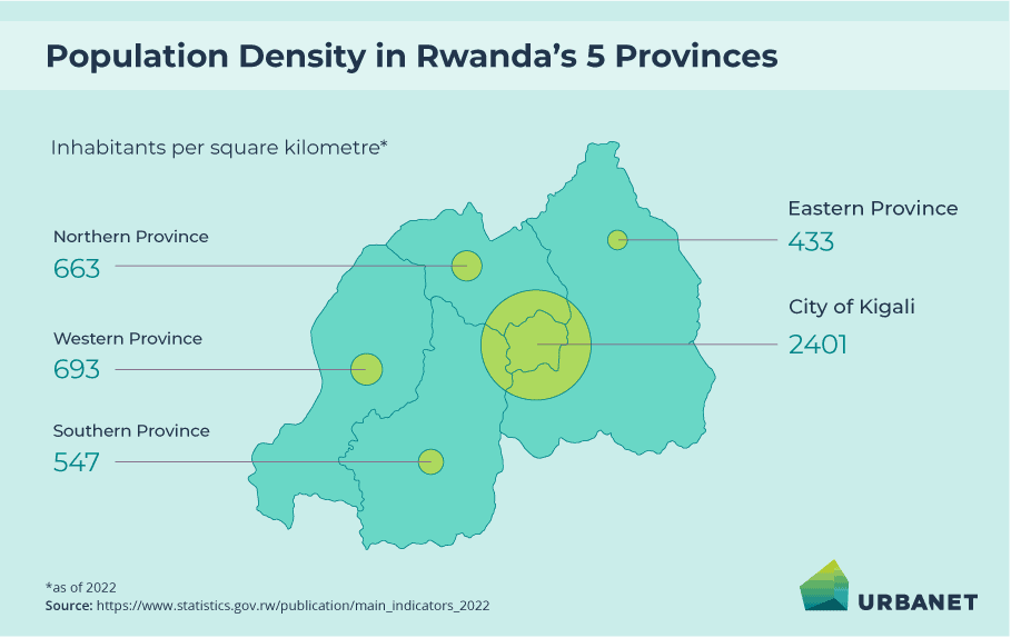
Urbanisation in Rwanda – Population Density in Rwanda’s 5 Provinces | Rwanda Infographics © GIZ
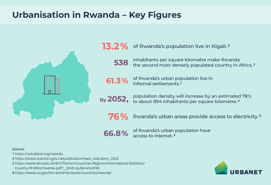
Urbanisation in Rwanda – Key Figures
Rwanda is a comparatively small and, densely populated country. With 538 inhabitants per square kilometre on average, Rwanda is the second most densely populated country in Africa. This number will increase even more: By 2052, an estimated 894 inhabitants per square kilometre will live in Rwanda. The country’s urban population is centred in Kigali as approximately 13.2 per cent of Rwandans live in the capital. However, a large part of the urban population – 61.3 per cent – lives in informal settlements. Moreover, within urban areas, only 66.8 per cent of the people have access to the Internet and 76 per cent can access electricity. This highlights the precarious state many people living in urban areas find themselves in.
Urbanisation in Rwanda – Key Figures | Rwanda Infographics © GIZ